Thematic Maps of Austria
Thematic maps are used to show data for specific topics in different geographical areas. These area a few examples.
Proportional Symbol Map
 Uses symbols of different sizes to represent data from different areas, in this case it is for Austria's industry centers. So you can see the many textile centers, which are spread throughout the country, as well as the iron and steel which is mainly together near the center of Austria.
http://www.lib.utexas.edu/maps/europe/austria_indust_centers_1969.jpg
Dasymetric Map
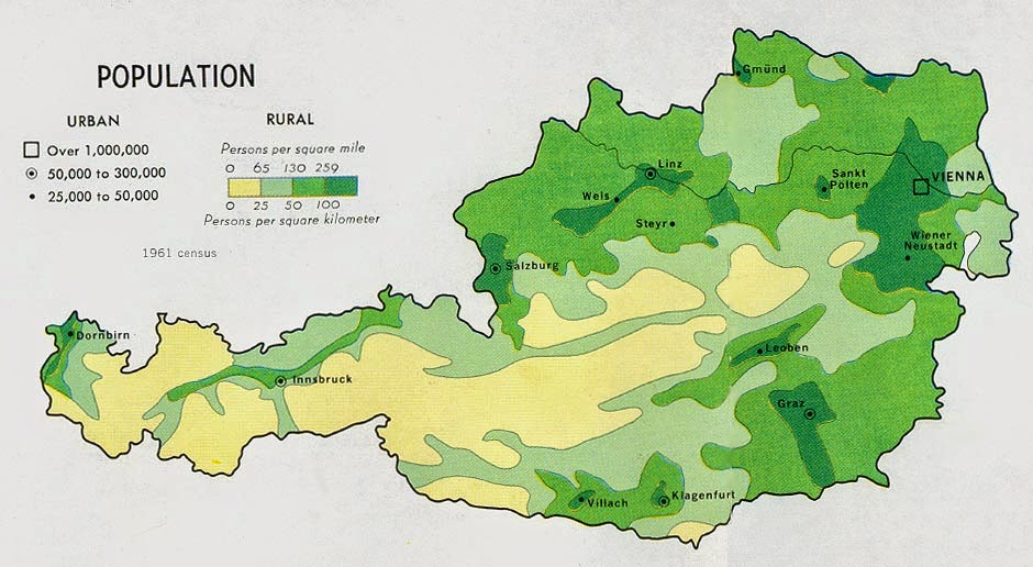 This is similar to the chloropleth map, however, instead of set regions, it shows the distribution of where the data is popular.
http://www.lib.utexas.edu/maps/europe/austria_land_1969.jpg
Isopleth Map
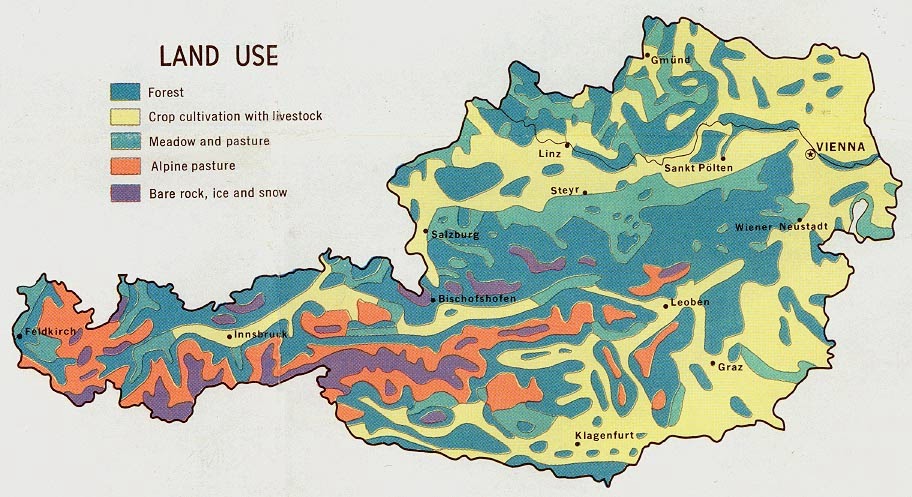 Shows, in this case, the level of land use in Austria, so you can see the large areas of forest, and crop cultivation with livestock, as well as the smaller areas of simple bare rock and snow, and then the alpine pastures.
http://www.lib.utexas.edu/maps/europe/austria_land_1969.jpg
No comments:
Post a Comment